


“Borders: From the First Sumerians to the Last Starfighter” by Jim Beall
Borders are all around us, some made by nature, some by man. Below is possibly the most recognizable manmade border of them all, The Great Wall of China.
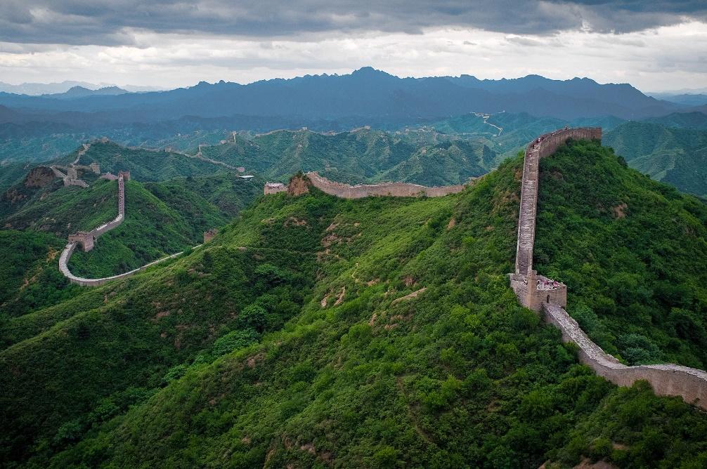
The Great Wall of China at Jinshanling
Image Credit: Severin.stalder, Wikimedia Commons
But what is a border, when did they begin, and why do we have them?
Intrinsically, a border identifies that the two areas it separates are somehow different. Often each side is a different country, while other times they mark a change in ownership within the same polity.
The earliest documented borders were those in ancient Sumer, located in the Fertile Crescent between the Tigris and Euphrates Rivers. That theirs are the first ones to be documented is not surprising, since the Sumerians appear to have been the first to invent writing (~3500 BC), and thousands of their cuneiform tablets and inscribed monuments have survived. (NOTE 1) Perhaps showing how some things never change, one surviving ~3000 BC tablet (currently in the British Museum in London) details the allocation of beer:
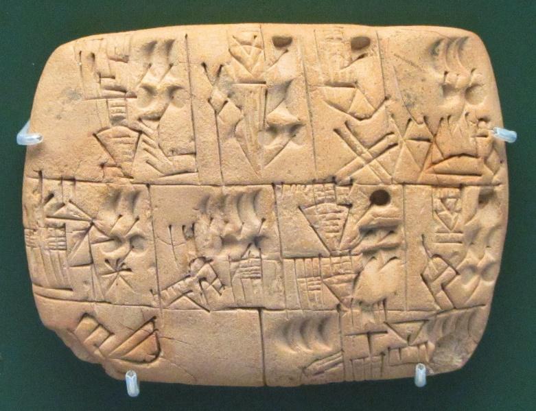
Record of Beer Allocation
Image Credit: BabelStone, Wikipedia
The city states of ancient Sumer shared a common theological pantheon, but the cities were typically built around temples to a specific patron god. The cities grew in population (NOTE 2) and were often at war with each other over the control of barley fields needed to feed their burgeoning populations. One such conflict around 2400 BC is related on “The Cone of Enmetana.”
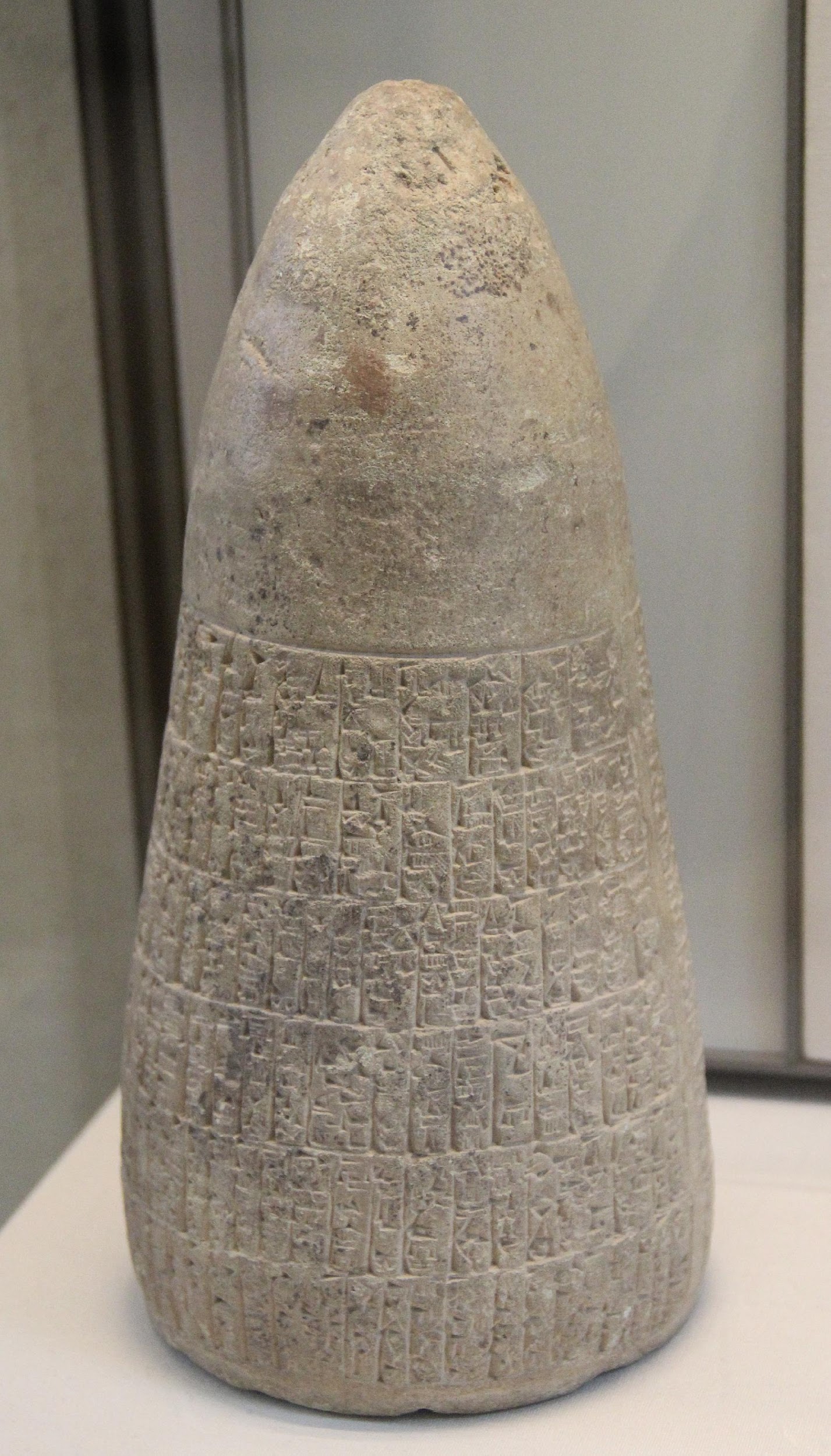
The Cone of Enmetena (Louvre Museum)
Image Credit: Gary Todd, Wikipedia Commons
The beginning of the inscribed text is what is of interest here, as it details the pre-war border between the city states of Lagaš and Umma:
Enlil, king of all the lands, father of all the gods, by his firm command, fixed the border between [gods] Ningirsu and Šara.
Mesilim, king of Kiš, at the command of [goddess] Ištaran, measured the field and set up a [border] stele there. (NOTE 3)
The wording decrees that the border was not some human secular or military matter, but an agreement between gods, perhaps reflecting the resolution of some god-to-god dispute. For centuries, the borders of the Sumer city states fluctuated with the results of each conflict portrayed as the jockeying of city patron gods within their pantheon.
The Egyptians of antiquity also needed borders, not to formalize changes in farmland ownership but to preserve the existing ones. The River Nile flooded the fields every July-August, leaving a muddy and changed landscape when the waters receded in September-October. The only way to preserve the layout and ownership of farm tracts was to regenerate all the property boundaries every year. Thus, the need for empirically accurate property borders forced the Egyptians (~3000 BC) to create an entire field of mathematics: geometry.
Setting such border markers is not a problem limited to foreign lands in antiquity, however. The American Colonies provide a much more recent and close-to-home example. Between 1632 and 1681, three different British kings (Charles I, Charles II, and James II) issued three conflicting land grants to Cecil Calvert (Second Lord Baltimore) and William Penn involving the lands that would become Maryland, Pennsylvania, and Delaware.
Drawing a consolidated border was deemed near impossible, as it would not be straight, but include arcs, tangents, and even a transpeninsular bisecting line. Border conflicts grew steadily worse until another British monarch—King George III—demanded in 1760 that the parties resolve the dispute. Accordingly, the Penn and Calvert families (William Penn had died in 1718, Cecil Calvert in 1675) hired two expert British astronomer-surveyors. It would take them almost six years and was only possible due to cutting-edge equipment.
The task required inventing a new methodology (NOTE 4) that included astronomical sightings, often requiring waiting out epic rainstorms in tents. Also, to be able to sight down their lines, they had to cut a 30-foot-wide swath the entire 233-mile length. (NOTE 5)
The two left about three hundred stone markers along their surveyed lines. (NOTE 6) Most marker stones contained a “P” on the side towards Pennsylvania, while the opposite side had an “M” for Maryland. Every fifth mile, a larger “crownstone” was placed with the Penn family coat of arms one side and the Calvert family coat of arms on the other.
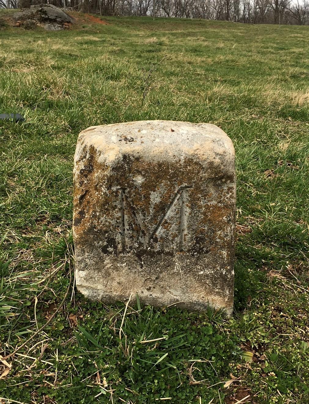
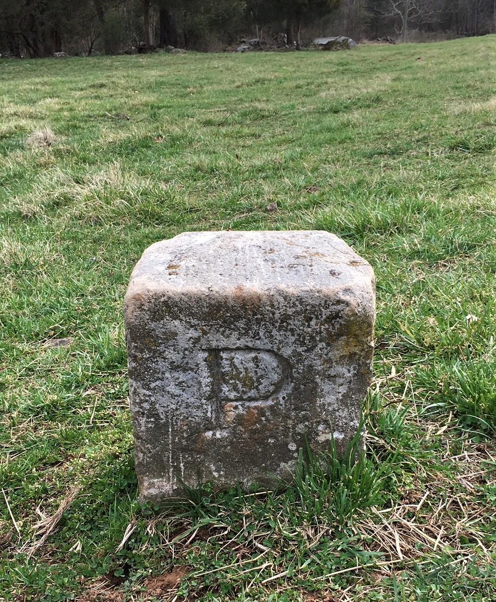
Mile Markers Images Showing North and South Faces Crownstone
Courtesy of Eric B. Gladhill (NOTE 7)
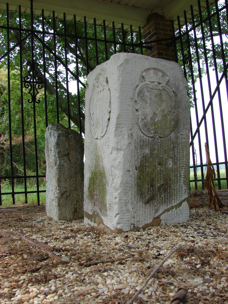
Image Credit: Steve Fernie,
AlbinoFlea, Creative Commons (NOTE 8)
The surveyors were Charles Mason and Jeremiah Dixon, and the border would become known as “The Mason-Dixon Line.” It has been called a technical achievement akin to the Moon landings. (NOTE 9) Despite being resurveyed several times with steadily improved equipment including satellites and GPS, the legal border remains the straight lines between where the 18th Century surveyor pair placed their stones.
Comparing the Mason-Dixon Line with those two ancient ones reveals startling parallels. Much like the Sumerians, the border was decreed by one king to resolve differences between other kings, and specified humans were ordered to place the markers. Like the Egyptians, Mason and Dixon had to invent a new methodology for border calculation.
The borders discussed so far have consisted of lines drawn between markers. Many others, both modern and ancient, have been physical barriers, as was the Great Wall of China. The purpose of such borders is not merely to identify a change (such as ownership) but to enforce it. These types of borders are expensive to construct and maintain, however, and so are generally built due to a need to enforce the change, with defense the most common historical reason.
Barrier borders do not simply enforce change, however. They create change. Consider perhaps the greatest barrier border on our planet: the Himalayas:
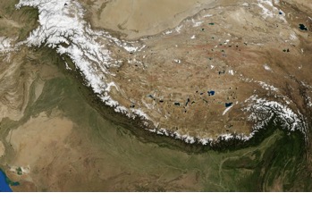
Orbital View from NASA Landsat 7 Satellite
Source: Wikipedia, Public Domain
Caused by the collision of two tectonic plates that began about fifty million years ago, the mountain range is of such height and length that it obstructs weather patterns giving the northern side very different weather than the southern side (note in the above image the green to the south versus the brown to the north).
It turns out that human barrier borders have analogous effects. Consider another famous wall from antiquity: Hadrian’s Wall in Britain, commissioned by that Roman Emperor in 122 AD to be the northern border of the Empire. The Romans were master builders, and the three Legions assigned the task took only six years to complete the seventy-three miles across the width of Britain. Much of the wall remains today and is a very popular tourist attraction and hiking route.

Image Credit: Steven Fruitsmaak
Source: Wikimedia Commons
Rome invaded Britain (“Britannia”) in 43 AD and conquered much of it by 87 AD. Efforts to complete the conquest of the northernmost areas were largely unsuccessful. (NOTE 10) Hadrian’s Wall was intended to protect the southern, “Romanized” lands from the northern barbarians. As can be seen in the image below, much more than a simple wall was involved. Small fortifications (“Milecastles”) and much larger forts (NOTE 11) dotted the entire length.
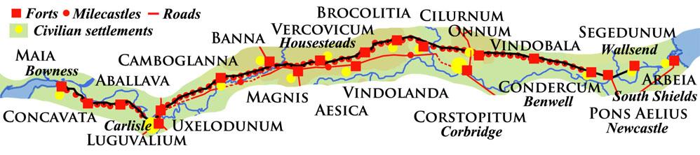
Map of Hadrian’s Wall Showing Defense and Civilian Sites
Image Credit: David Simpson and Tangled Worm (Note 12)
Thousands of Roman soldiers garrisoned Hadrian’s Wall from 122 AD to 410 AD. Support personnel, like farriers and farmers, well outnumbered the soldiers, and entire villages sprung up around the forts on the southern side of the Wall. In contrast, the northern sides near the wall were empty of habitation by the unconquered tribes. Thus, like the Himalayas, the landscape was markedly different on each side of the Wall.
That is not the only change created by Hadrian’s Wall, however. The Romans recruited soldiers from all over the Empire, but units were never used where they were formed, lest the effect be the training of revolutionaries. Instead, they were always deployed far from home. Records have identified most of the military units (Cavalry Roman Auxiliaries) who staffed those forts: (NOTE 13)
Fort Name |
Soldier's Origin |
South Shields |
France, Iraq |
Wallsend |
France, Belgium |
Newcastle |
Germany, Britain |
Benwell |
Spain, Germany |
Rudchester |
Germany |
Halton Chester |
Hungary |
Corbridge |
Spain |
Risingham |
France, Germany, Switzerland |
High Rochester |
France, Spain |
Chesters |
Spain |
Carrawburgh |
Netherlands |
Housesteads |
Germany, Belgium |
Chesterholm |
Belgium, France |
Great Chesters |
Belgium, Spain, Switzerland |
Carvoran |
Syria, Croatia |
Birdoswald |
Romania |
Bewcastle |
Romania |
Castlesteads |
France, Belgium |
Netherby |
Spain |
Stanwix |
France |
Burgh by Sands |
Germany, Algeria/Morocco, Netherlands |
Drumburgh |
unknown |
Bowness |
unknown |
Birrens |
Belgium |
Beckfoot |
Hungary |
Maryport |
Spain, Croatia, Netherlands |
For nearly three centuries, men from all over the Roman Empire lived decades of their lives in Britain as they served in those units along the wall. Many raised families (or otherwise had children) there, making significant contributions to the genetic diversity of the population. Thus, the border called Hadrian’s Wall resulted in some quite unexpected and lasting changes.
Returning to the Great Wall of China, the simple version of history states that the emperors had it built to keep out northern invaders like the Mongols. That is correct, but the full story is much more complicated.
First of all, walled borders existed as much as three centuries (“The Spring and Autumn Period”) before the 250-year long “Warring States Period” that itself ended in 221 BC when one king, Qin Shi Huang, conquered the others. One of the first acts of the first Emperor was to tear down all the separating walls. He did this to extinguish internal borders, remove wall-caused differences, and unify his new domain into a common culture.
Second, Qin preserved the existing out-facing walls and even used the material from the destroyed ones to strengthen and extend them.
Third, many subsequent dynasties built and rebuilt sections of the Great Wall. A complete picture with timelines is presented below.

Image Credit: Maximilian Dörrbecker (Chumwa)
Source: Wikimedia Commons
The map shows the massive scale of the Great Wall not only in distance, but also in time. Hadrian’s Wall was built in six years by three Legions (roughly 15,000 men) and was 73 miles long. Great Wall construction took place over a period of about 2,500 years, involved about four million people, and is 13,171 miles long. (NOTE 14)
The Great Wall had the same effects previously discussed with Hadrian’s Wall, but the scale of the project caused even more changes. According to historians, Emperor Qin sent one million to build the Wall. Of those, about 400,000 died during the project, with many being buried in the Wall itself. Scholars have estimated the total millennia-long total death toll at about one million, and the Chinese referred to the wall as “the longest cemetery on Earth.”
Walls that are not borders can also cause change, some quite unexpected. A potato blight resulted several years of famine in Ireland and Scotland beginning around 1845. The death toll from starvation and related illnesses was immense. Many of the landed gentry commissioned work projects to help feed their local populations, leading to numerous so-called “famine walls,” “famine follies,” and “starvation roads.” (NOTE 15)
Some seventy-five years after construction, one such famine wall would save a fine and historic castle, but not in the “traditional” way.
In the early 1920s, over three hundred of the great houses in Ireland were burned by the Irish Republican Army (IRA). In 1922, when the IRA gangs came to attack and burn down Castle Leslie, the locals denied them access (they even cut their phone lines). The folk pointed to the famine wall around the estate and said the Leslies had fed them all through the Famine Years, and they would not tolerate actions against them. Thus, the building of the wall—not the wall itself—preserved the Leslie home. (NOTE 16)
Famine walls and famine follies (NOTE 17) dot the landscapes of both Ireland and Scotland. The building of each one fed men and their families. Many walls marked the boundaries of fields or estates, while others served no apparent purpose. Among the more famous in this last group is the wall across the Scottish mountain named Suilven. The slope challenges hikers, yet workers somehow moved and set heavy stones in a perfectly functional (but useless) wall all the way up the crag, across it, and back down again.
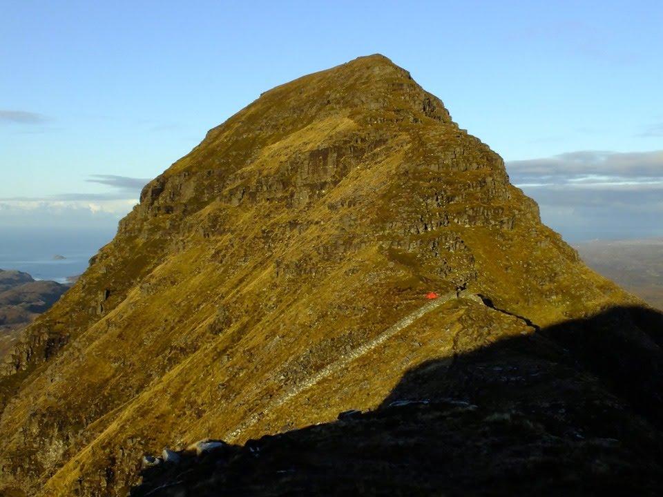
Suilven Famine Wall
Image Courtesy of Shane Younie (NOTE 18)
A Demilitarized Zone (DMZ) contains, in effect, a border along its center. The DMZ in Korea is about four kilometers wide and two hundred kilometers long. It was created in 1953 when the military forces of the two warring sides pulled back two kilometers from a ceasefire line. That DMZ is kept generally deserted of human life (NOTE 19), so other life tends to flourish. Among the species making their homes in the DMZ are endangered Asian cranes, black-faced spoonbills, angora goats, Amur leopards, and even bears. (NOTE 20)
Such borders and their effects are not unique to military conflicts. The mitigation measures after the Chernobyl disaster, for example, included the evacuation of about one thousand square miles around the stricken facility. A fence border surrounds the “Chernobyl Exclusion Zone,” which is almost uninhabited. (NOTE 21) Photos of the zone include poignant images of crumbling homes and rusting playgrounds, but other images reveal lush greenery teeming with wildlife, including bears, bison, wolves, lynx, wild horses, and dozens of bird species.
U.S. nuclear power plants provide another example of how Nature takes advantage of manmade borders. Each reactor plant is within a fenced “Owner Controlled Area.” Wildlife flourish there, especially since hunters are excluded by patrols of highly-armed guards.
Such wildlife exploitation of hunter-free zones was previously observed at early federal reactor sites. One illustrative anecdote from the author’s personal experience comes from the USN nuclear prototype facility near Schenectady, New York. Presumably, a bear was sighted in the distance through a fence as it ambled about in the brush. Concerned locals were told by enterprising sailors that a woodchuck had denned near one of the reactors and mutated to great size. The author only learned of the incident many years later during his naval training there after being asked by one earnest citizen if he had seen “Woodie.” (NOTE 22)
Turning to science fiction, the largest border wall in recent filmography may be the 700-foot-tall ice barrier in “The Game of Thrones” HBO television series (2011—2019). The episodes were based on the science fiction-fantasy book series of the same name by George R. R. Martin, with the first book published in 1996. The story’s massive ice structure stretched 100 leagues (~345 miles) along the northern border of what was called, “The Kingdom of the North.”
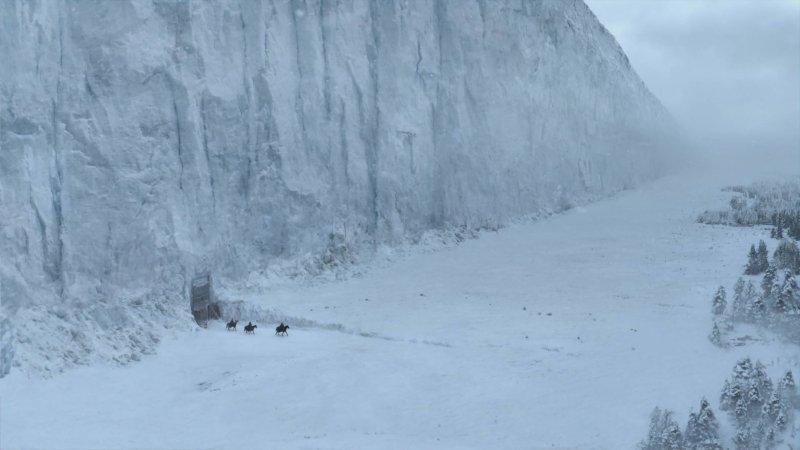
“The Wall” of Game of Thrones
Image Credit: HBO
According to both the books and the episodes, The Wall pre-dated the current characters, was built by means and people not entirely known, and fends off terrible creatures of legend who live on the other side. Like the Himalayas, the weather appeared to be different on one side than the other. As shown below, this is not the only similarity to other barriers.
Perhaps the earliest (1933) famous “border wall” in science fiction filmography is the one below:
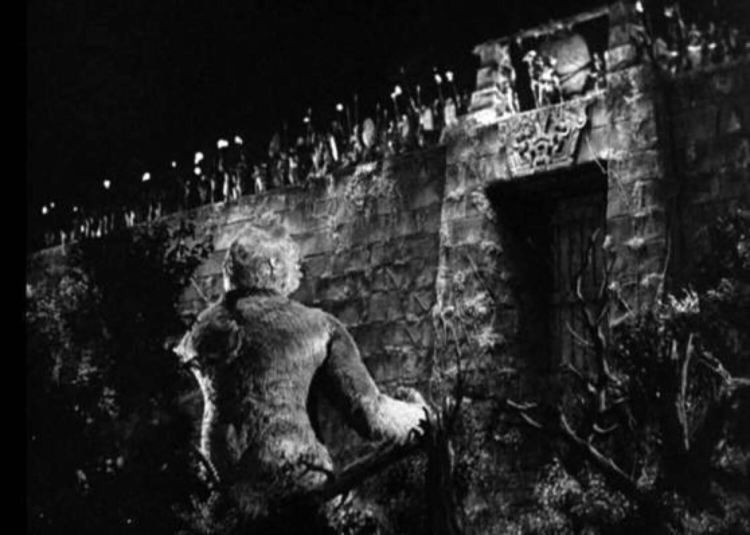
King Kong at the Skull Island Wall
RKO Radio Pictures, 1933
Per the movie and its release information, the wall had not been built by the current islanders. Rather, it was ancient, its builders were unclear, and they had used capabilities completely beyond present local knowledge to create a walled structure far taller and stronger than was possible at the time of the story, and it kept out dinosaurs and other huge creatures. The parallels with “The Wall” in the Game of Thrones are almost exact. (NOTE 23)
Impressive borders are hardly uncommon in science fiction, but the stories reach their peak only after they fail. “King Kong” was no exception!

King Kong Breaks Through
RKO Radio Pictures, 1933
Game of Thrones followed the same pattern:
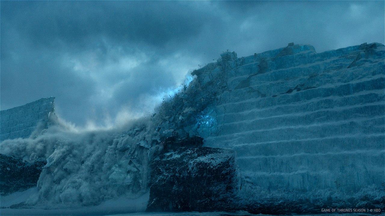
Breaching The Wall, Game of Thrones
Image Credit: HBO
Another famous wall in science fiction filmography can be found in “Jurassic Park.” Despite significant upgrades in technology, it suffers the same dramatic fate.
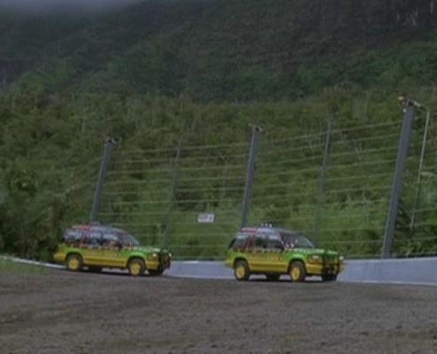 Jurassic Park High Voltage Electric Fence |
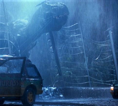 Tyrannosaurus Rex Breaks Through |
Image Credits: Universal Pictures, 1993 |
|
Basically, border walls in these kinds of stories exist mainly to be breached impressively at a plot-appropriate moment and, until then, serve chiefly as a stage setting for the development of characters as they train, patrol, and cope with boredom. (NOTE 24) The many thousands of Roman and Chinese soldiers stationed for decades along their own walls would have understood perfectly.
Nature has also provided outer space with borders, and science fiction authors have not stinted in using them.
The “discovery” of the first of these was in the 1750s by mathematicians Leonhard Euler and Joseph-Louis Lagrange. That is, they calculated that five points (“L1” through “L5”) around any two large bodies in space would be stable, in that the two known gravitational fields would offset each other. (NOTE 25) As long as objects were placed within a tightly bordered volume, they would theoretically stay there. Crossing the border in any direction, however, would allow one of the gravitational fields to capture the object. The below image shows the locations of the five points, with the relative gravity fields depicted topologically:
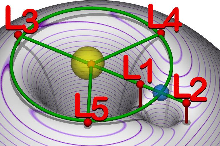
Lagrange Points of a Two-Body System
Source: Wikipedia, Public Domain
Space scientists and science fiction writers alike have subsequently used Lagrange points. Several space missions have placed probes and sensors in Sun-Earth and Earth-Moon Lagrange Points, confirming the math. Scientists have also detected natural space objects at the Lagrange Points of several other two-body systems within the Solar System.
The 1975 NASA Summer Study that produced the famous “Stanford Torus” space habitat design relied on using not one, but two Lagrange Points! (NOTE 26)
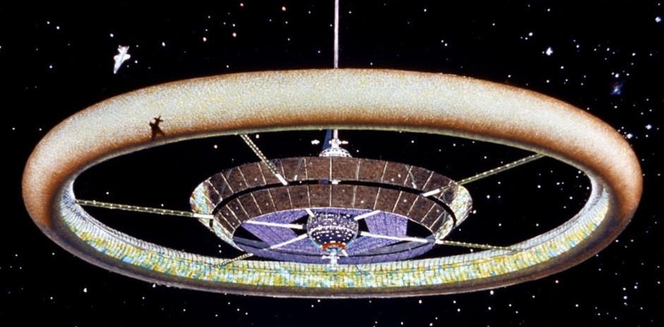
Stanford Torus
Image Credit: Wikipedia, Public Domain (NOTE 27)
Most of the habitat’s mass would be mined on the Moon and launched at a “mass catcher” at Earth-Moon L2. From there the material would be brought to Earth-Moon L5 for industrial processing into habitat construction. Unsurprisingly, science fiction has featured a plethora of stories of space stations and habitats deliberately placed at various Lagrange Points all over the solar system.
A second outer space border involves black holes. Black holes can be new, created as part of a supernova, or as old as the first years after the Big Bang. They can be ultra-massive (TON 618 is estimated at sixty-six billion times the mass of the Sun) or theoretically comparatively lightweight (primordial ones could possibly be the mass of asteroids). What they all have in common are the strictest borders in the known universe. Specifically, due to their enormous gravitational fields, anything (including photons) that crosses one can never cross back out.

Black Hole at the Center of Galaxy M87
Image Credit: EHT collaboration
Acknowledgment: Lia Medeiros, xkcd
A great many science fiction stories have used various features of black holes, including the time-slowing aspects near the edge of that border. Among the author’s favorites are Gateway (by Frederick Pohl, 1977) and Flies from the Amber (by Wil McCarthy, 1995). In both novels, the characters must make decisions based on the consequences of their emergence from the event horizon at the edge of the border of a black hole.
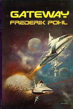
Gateway |
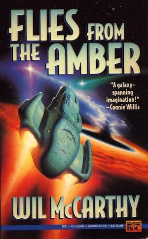
Flies from the Amber |
A third group of outer space borders consists of wormholes. One fundamental element of science fiction is crossing the vast distances between stars and galaxies in short enough time periods for a story to be practical. In many cases, the stories postulate faster than light (FTL) engines, such as “warp drive” or “hyperspace drive,” but exceeding the speed of light violates current theoretical physics. (NOTE 28)
Wormholes have always offered undeniable real-world possibilities because Einstein himself agreed that general relativity suggested they were mathematically possible. The solution is called an Einstein-Rosen Bridge (or Lorentzian wormhole, or Schwarzschild wormhole). As a propulsion method, however, the math is not promising as it also suggests any such wormhole would close faster than anything, including photons, could traverse it. Nonetheless, Einstein’s "blessing" has led to wormholes being used extensively in science fiction as a means of traveling to distant locations in shorter times than light would require in normal space.
In some storyverses, wormholes are depicted as funnel constructs, as in the “Star Trek Deep Space 9” television series. In others they appear as surfaces through which something enters and then exits at another location, as in the movie “Stargate” and subsequent television series:

Bajoran Wormhole, Deep Space 9 |
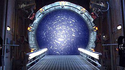
Stargate, SG-1 |
In contrast to FTL drives that can deliver ships to any location, wormhole-style gates provide science fiction authors with borders that can be attacked, defended, and breached. Ones like Star Trek’s Bajoran Wormhole are natural phenomena whose apertures are permanently locked in place. (NOTE 31) In contrast, the ones in Stargate are created by equipment that is mobile and can be activated or deactivated by the operators. Science fiction abounds with variations on the above themes, and each one creates different border effects and subsequent plot elements.
In one outstanding example, John Ringo’s Into the Looking Glass (Baen Books, 2007) begins with the inadvertent creation of a permanent interplanetary gate in Florida and, hence, a new border to be either exploited or defended. Then more gates begin spawning all over the Earth, seemingly to random planetary surfaces across the galaxy. Each gate creates a new border, including one that becomes a DMZ far more fortified than the one in Korea. Story twists and opportunities abound, including a memorable reprise of the Paul Revere story when aliens invade through a new gate, and a police radio dispatcher takes on the role of the Revolutionary War hero with “rednecks in pickup trucks” the Minutemen. (NOTE 32)
Some story universes combine naturally occurring wormholes with ones that are either caused or opened by devices. One leading example of this is the "Starfire" series, originated by David Weber and Steve White in 1990, which began based on the game system by the same name (created by Stephen V. Cole in 1979). (NOTE 33) The series posits that wormholes come in several classes, with some already “open” that can be defended by “space forts” and other local forces. Other wormholes, however, are closed (but can be opened by technology). Some of those “potential” ones can only be detected from one side, thus posing risk of surprise attacks and the need for rapid response fleets. The combinations of threats and opportunities offer a great variety of both tactical and strategic areas for authors to exploit.
 Into the Looking Glass (2007) |
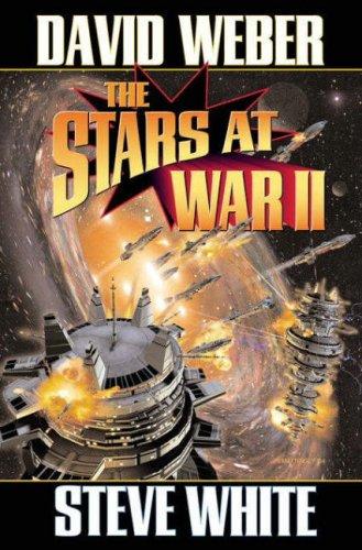 The Stars at War II (2005) |
Images courtesy of Baen Books |
|
One last form of “gate” in science fiction never defines itself as a wormhole, but simply an opening to another place. It acts like teleportation but, instead of some device or force relocating an item, the object or person simply physically passes through an artificially created opening. One significant early example of this is “The Big Front Yard,” the 1959 Hugo winning novelette by Clifford Simak. In that story, one alien race apparently opens interstellar gates simply as its species’ mission. Once opened, the aliens depart again, leaving the gates open for passage. Humanity only learns of this when the protagonist discovers that his front yard contains one such gate and soon finds himself dickering with various aliens as they peacefully pass through.
John Ringo revisited this theme in his 2010 novel, Live Free or Die,” the first in his “Troy Rising” trilogy. (NOTE 34) As in Simak’s story, a gate is opened by one alien race (who promptly depart to open more elsewhere), and it is then used by many other races. In Ringo’s novel, however, the gate is not a person-sized doorway in a front yard, but a kilometers-diameter one at the Sun-Earth L2 Lagrange Point. Peaceful traders are again the first visitors, but then come mass-murdering thieves in warship fleets with lots and lots of missiles. The gate becomes the Solar System’s border that must be defended at all costs.
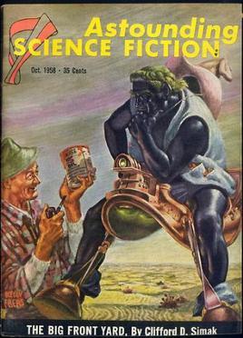
“The Big Front Yard” (October 1958) |
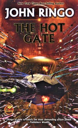
The Hot Gate (2011) |
Physical barrier borders can be walls or mountains, but distance can be even more effective. The watery width of the English Channel, for example, kept the peoples of the British Isles mostly separate from Europe. After the Romans left, the Saxons invaded, followed by the Vikings and then the Normans. In the end, however, the Channel isolated them and the land absorbed them all. In more recent times, the Channel stopped conquering annexation by Napoleon and Hitler. In the current day, the UK culture has continued to remain so distinct from the rest of Europe that the UK withdrew from the European Union.
As effective as the English Channel has been, the great breadth of the Atlantic Ocean was decisive in the American Colonies drifting culturally apart from England and then allowing the American Revolution to succeed. Science fiction authors have already recognized the likelihood that the vast distances of outer space will inevitably drive self-sufficient off-world settlements to seek independence. (NOTE 35) Human history strongly suggests that cultural divergence would then occur eventually leading to armed conflicts which could produce death tolls not in the thousands or millions, but in the billions.
There may be only two ways polities that sprawl across outer space can maintain cohesive unity. The first is by ubiquitous doorway-style gates that allow so much intermingling that they preserve culture homogeneity. The second is the confirmed existence of one or more dire external threats.
Science fiction authors have written it both ways. When we settle space, let us hope for the first.
NOTES:
1) The Sumerians are not only the first civilization known to use writing, but also wheels, fast wheels (chariots), a legal code, and ships. In the area of mathematics, they may have been the first to be able to calculate the area of a triangle and the volume of a cube. They also identified the five planets visible without telescopes. The oldest known written literature, the “Epic of Gilgamesh,” is from Sumer.
2) The Sumer city of Uruk is generally regarded as the first true city, reaching a population of about 80,000 in 2900 BC).
3) The text on this historical object has been translated many times and, while the wordings vary in detail, they are consistent in substance. The version here is from Wikipedia, with some clarifying words added in brackets.
4) A brief description of the methods they employed is presented here:
https://caf783ab-f4aa-469d-a4ff-2c3a19268299.filesusr.com/ugd/6f029b_b08999b366b24ef79bdbeff2278b80e0.pdf
5) For a comprehensive and wonderfully readable account of their efforts, the author recommends:
Drawing the Line: How Mason and Dixon Surveyed the Most Famous Border in America, by Edwin Danson, Published by John Wiley & Sons, 2001.
6) Few of the original stones remain in place. Many now reside in museums, having been replaced with replicas. The fates of many others, however, remain unknown. While on their way back, the two Englishmen found one already missing. A farmer had dug it up to use as a tombstone for his dog.
7) Eric Gladhill is licensed as a Property Line Surveyor in Maryland and a Professional Land Surveyor in Pennsylvania. He serves as a Director for the Pennsylvania Society of Land Surveyors (PSLS) and is a member of the Maryland Society of Surveyors (MSS). He is currently serving as the PSLS representative to a joint endeavor between these two societies to inventory and document all of the remaining Mason-Dixon stones marking the border between those two states. He is the author of both a book and numerous articles on land surveying:
https://www.amazon.com/Finding-My-Boundaries-Interesting-Surveying/dp/B096TJQNCQ
https://www.xyht.com/author/eric-b-gladhill/?fbclid=IwAR0Mq8pQ2NZvmMI204MFXaCOdSH0P6ICIdZM__meXc3LCs4z7FAWqcka1_A
8) The reason that both coats of arms are visible, rather than being on opposite faces, is because this is one is at the apex of an angle. Specifically, it marks the intersection of the Tangent Line and the Transpeninsular Line at the Maryland-Pennsylvania-Delaware Border.
9) Source: https://www.bbc.com/news/uk-england-40638673
10) One anecdote from Dio Cassius’ Epitome of Book LXXVII provides an insight into the depth of the northerners’ belligerent stubbornness. The Roman historian recounts a conversation that supposedly took place between the wives of Caledonian tribal chieftain Argentocoxos and Emperor Septimius Severus during one set of truce talks. The Empress of the Roman Empire made a disparaging comment about the sexual conduct of the tribal women. The other replied, “We fulfill the demands of nature in a much better way than do you Roman women; for we consort openly with the best men, whereas you let yourselves be debauched in secret by the vilest.”
11) For a detailed video reconstruction of one of the larger forts, the one at Vindolanda, see:
https://www.youtube.com/watch?v=ZnPGb5L7aZ4
12) For more information, including photos, see:
https://englandsnortheast.co.uk/hadrians-wall/
13) Source: https://segedunumromanfort.org.uk/learning/where-did-the-soldiers-living-along-hadrian-s-wall-come-from?fbclid=IwAR3DIk6XQe5668TJR5vMkA0WDDw5mmPTNSD7GFyWF_8oMUCNFxkWS0tarY8
14) In 2012, based on existing research and the results of a comprehensive mapping survey, the National Cultural Heritage Administration of China concluded that the remaining Great Wall associated sites include 10,051 wall sections, 1,764 ramparts or trenches, 29,510 individual buildings, and 2,211 fortifications or passes, with the walls and trenches spanning a total length of 13,171 miles. Some of the wall sections were dirt and many sections have eroded away. The sections most visited by tourists were built or rebuilt during the Ming Dynasty, which ruled from 1368 to 1644.
15) The Victorian Era did not favor giving charity to the able-bodied. This went both ways, as those able to work would often reject charity out of pride.
16) “Christina Leslie ran the [Leslie] Estate in the 1840’s . . . She reduced and canceled farm rents, built soup kitchens to feed many, organized voluntary passage to the USA and Canada and built the 4 mile famine wall around the Estate as a relief project.” Source:
https://www.castleleslie.com/wp-content/uploads/2018/03/leslie-family-history.pdf
A powerful recounting of the period, including the survival of Castle Leslie due to its Famine Wall, is presented in the documentary series, “Tales of Irish Castles, Season 1, Episode 6.”
17) Images and descriptions of several beautiful “famine follies” can be found here:
https://www.amusingplanet.com/2017/10/irelands-famine-follies.html
18) Shane Younie is a winner of Scotland’s Moray Mountaineering Club (https://moraymc.wordpress.com/) President’s Award for Mountaineering Achievement. More of his images can be viewed here:
https://www.instagram.com/shaneclimbing/?hl=en
19) One legacy village of about two hundred is allowed to continue farming a portion.
20) The author had personal experience with another DMZ while serving as an engineering officer aboard USS Long Beach (CGN-9) in the Gulf of Tonkin during the early 1970s. The ship’s role was PIRAZ (Positive Identification Radar Advisory Zone) and her long-range radar and TALOS missiles interdicted enemy aircraft from entering the airspace of the Vietnam DMZ. The Long Beach was credited with shooting down two MiGs attempting to breach the DMZ, though not while the author was aboard.
21) A few locals either refused to leave or returned after the immediate emergency passed.
22) On the other hand, the author does not avow knowledge of the characteristics or lifespans of mutated woodchucks.
23) Despite those parallels, Game of Thrones author George R. R. Martin stated in a 2014 that his inspiration for “The Wall” actually came from a visit to Hadrian’s Wall. Source: https://www.rollingstone.com/culture/culture-news/george-r-r-martin-the-rolling-stone-interview-242487/
24) The highly improbable deep space border wall along “The Frontier” in “The Last Starfighter” (Universal Pictures, 1984) was no exception.
25) Euler is credited with identifying the first three, followed by Lagrange the other two. In some documents, this is credited by using the term “Euler-Lagrange Points.”
26) Source: https://space.nss.org/settlement/nasa/75SummerStudy/Design.html
27) The image is a cropped version of the painting by Donald E. Davis, commissioned as part of the NASA study.
28) A special case called Alcubierre Drive is also used because it does not require an object to exceed light speed to achieve FTL displacement. For a brief summary, including the origin of the idea and some of the massive physics problems, see:
https://en.wikipedia.org/wiki/Alcubierre_drive
29) MorishitaKurumi is a gifted artist in Japan. More of her work can be found here:
https://www.deviantart.com/morishitakurumi
30) https://rdanderson.com/index.htm
31) The author’s favorite cinematic portrayal of this type of wormhole is this short video:
https://www.youtube.com/watch?v=mMZbig5t8Ug
32) Page 73, and the author will never look at a “bait and tackle” store the same again.
33) For a full list of Starfire titles, see:
https://www.baen.com/categories/books-by-series-list/starfire-series-by-david-weber-and-steve-white.html
34) The others were Citadel (2011) and The Hot Gate (2011).
35) A few examples: The Moon (The Moon is a Harsh Mistress, Robert A. Heinlein, 1966), the asteroid belt (“Known Space” series, Larry Niven, beginning 1984), Mars (Birth of Fire, Jerry Pournelle, 1976), and distant solar systems (Tactics of Mistake, Gordon R. Dickson, 1971).
Copyright © 2022 Jim Beall
Jim Beall (BS-Math, MBA, PE) has been a nuclear engineer for over forty years, a war gamer for over fifty, and an avid reader of science fiction for even longer. His experience in nuclear engineering and power systems began as a naval officer. Experience after the USN includes design, construction, inspection, enforcement, and assessment with a nuclear utility, an architect engineering firm, and the U.S. Nuclear Regulatory Commission (USNRC).